OSINT: Visual Evidence Where Journalists Can’t Go
One of the greatest challenges in modern journalism is reporting events that lack direct visual documentation. Governments, conflicts and geographic isolation often make on-the-ground reporting impossible. In these cases, our responsibility as editorial creatives is to reconstruct truth from fragments — using satellite imagery, open-source intelligence (OSINT) and careful visual verification.
OSINT is a collection of investigative stories produced at Radio Free Asia where visuals were scarce, restricted or suppressed. By combining geospatial analysis, imagery comparison and local sourcing, I worked with reporters and analysts to build credible visual narratives that broke international news. These projects demonstrate how evidence-based visuals can cut through disinformation, revealing stories otherwise hidden from the public eye.
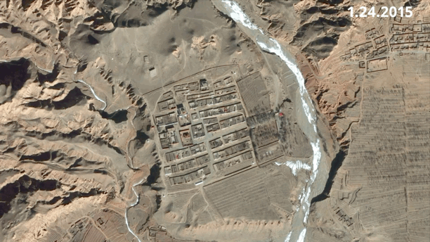
Tibet: Monastery Submerged
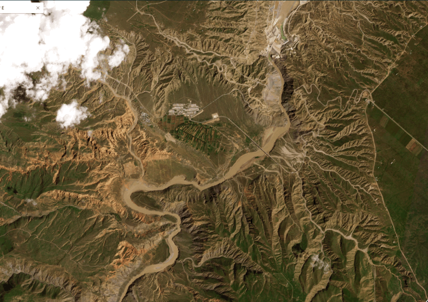
This time-lapse, composed from satellite images taken between Aug. 14 and Sept. 7, 2024, shows rising waters from a new dam in central China inundating the site of Atsok Monastery. The 135-year-old Tibetan Buddhist monastery, along with a nearby village, has now been submerged. Experts who analyzed the imagery, along with two sources inside Tibet, confirmed the destruction. This was exclusive breaking news.
Cambodia: Naval Base for China


Satellite imagery from August 2024 shows two Chinese People’s Liberation Army Navy Type 056 corvettes and related structures at Cambodia’s Ream Naval Base — despite official denials. The images, obtained by Radio Free Asia from Planet Labs, also reveal two additional vessels docked at a newly constructed Chinese-built pier, opposite the corvettes Aba and Tianmen, which have been stationed there since last year.(Graphic by Paul Nelson/RFA; Images by RFA and Planet Labs)
Vietnam-China Confrontation
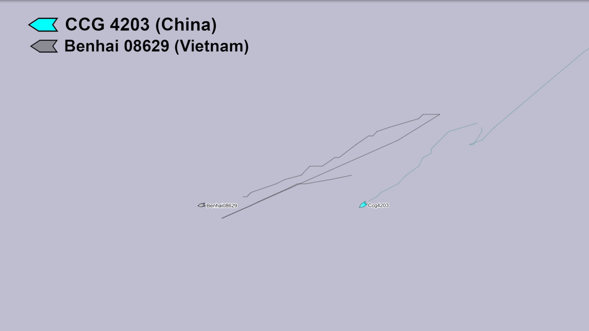
Chinese, Vietnamese ships stalk each other off Paracel Islands in South China Sea
Playback showing a Vietnamese vessel and a China Coast Guard ship navigating in close proximity in late February. Data: MarineTraffic; Analysis: RFA.
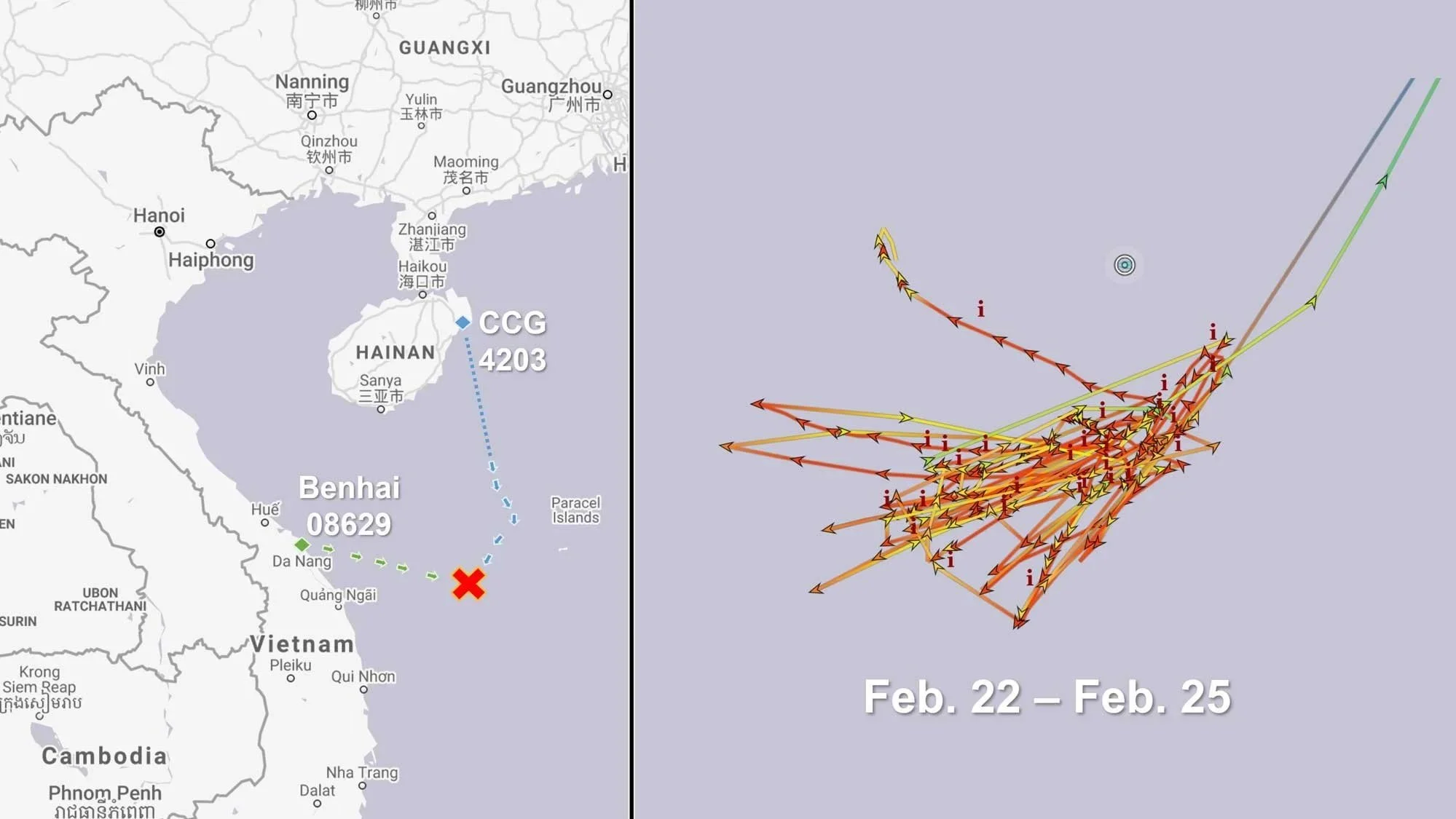

Map showing the location of the confrontation and the overlapping voyage history of the CCG 4203 and Benhai 08629 from Feb. 22 to Feb. 25. Satellite image showing Benhai 08629 and the CCG 4203 on Feb. 25. Image: Planet Labs; Data: MarineTraffic, Analysis: RFA.

North Korean leader’s lavish lifestyle visible by satellite

North Korean leader’s villa in Wonsan, as well as one of his yachts, can be seen in this January 2022 image. Credit: Maxar Technologies


Three of Kim Jong Un’s yachts can be seen at the port of Wonsan in this December 2019 image. Credit: CNES/Airbus